Posts Tagged Panoramic
Fife Coastal Path – Guardbridge to Tayport
Posted by squawking7000 in Fife, Fife Coastal Path, Historic Scotland, Scotland, Travels, Walking, Wee jaggy bits o' history on April 11, 2017
The lure of a good day was too much to resist, indeed any day in Scotland that does not rain is a good day but this one promised sunshine as well. This section covers the 11 miles from Guardbridge, through Leuchars to Tentsmuir Forest and around the coast to Tayport. A walk off highs and lows and all of it at sea level!
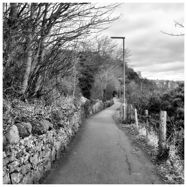
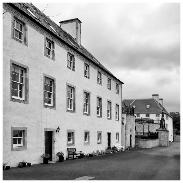
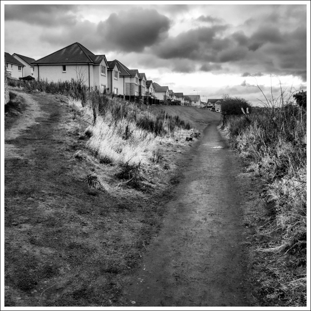
Leaving my car in the old Guardbridge paper mill car park, which was close to the line of the railway where I left Fife Coastal Path last week. The footpath didn’t last long and soon I was down at the roadside in front of the Paper mill clock. I’d like to say thanks to the University of St. Andrews for restarting this clock, time literally did stop when the mill closed and restarted when the University installed their big community heating boiler plant here.

From the Mill clock, the way forward isn’t clear, do you go to the left up the hill towards the houses or carry straight on towards Leuchars?
The glimpse of half a FCP sign on a lamp post by the roadside confirmed that I was to go ahead towards Leuchars, crossing the old bridge, with a benchmark symbol mid-span.

The way on the far side passes by a children’s play park and some houses before joining and then crossing the Leuchars busy road.
There is an aptly or inaptly named burger van here called the Wurst-Stop, presumably it is a play on words and not a statement of quality. I didn’t get a chance to find out as it was in the process of being set up when I passed and in the process of shutting up shop when I returned.
The next part is kind of sad for me, knowing RAF Leuchars as a vibrant base, walking past it today, without the roar of jets or the prospect of something interesting to look at was slightly depressing. There was the seemingly ever present throaty roar of the East of Scotland Universities Air Squadron, Grob Tutors overhead but that was poor compensation for the ear splitting noise from a Tornado.
I walked past the camp, around the bend and crossed the road to enter Wessex Avenue and from here it’s a matter of walking up this road and turning right…. but I didn’t do that.
In all the years that I have been on this planet, I have never really stopped and looked at St. Athernase Church, which can be seen as you cross the road into Wessex Avenue. The remarkable thing about this 11th century church is its architecture. It is the most northerly example of Norman architecture in the country. Even if you know nothing about architecture, you will immediately notice the rounded end to the building and it’s tiered construction and decorative carvings. The top part was a later edition.


A set of outside stairs to get to the upper gallery and a curious carved pillar with CRAIG SANQUHAr, the last letter being carved into the border, I wonder why this is here. Reused stonework perhaps?
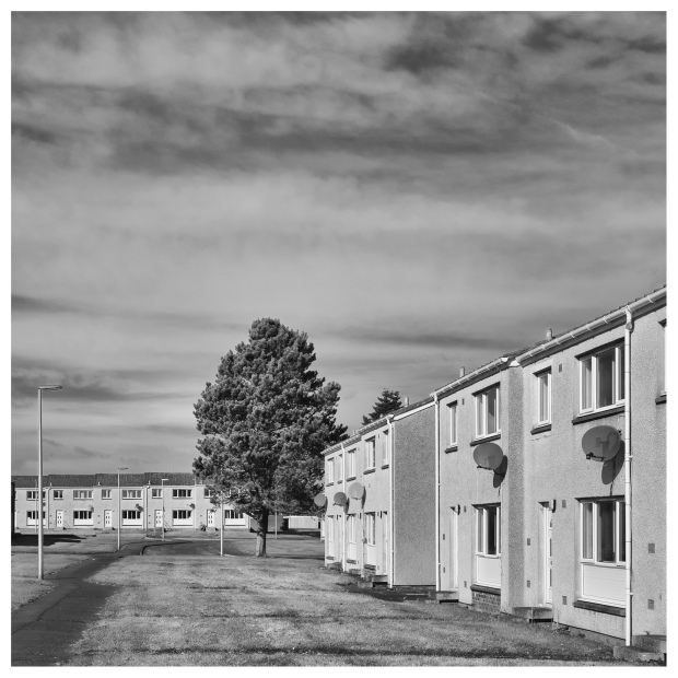
I thought I knew my way back to the route of the FCP after leaving the church and well I was nearly right. My walk took me though the Married Quarters for RAF Leuchars and the penny slowly dropped, there’s nobody about, all these houses are empty. What a crying shame.
I know that MQ are not the most glorious of houses but they are a roof over ones head for someone.
Anyway I found my way back onto the FCP, which goes up Earlshall Road. There is a footpath behind a hedge that leads onto a field running parallel to the road it’s not signposted but it will get you off the road if you wish, it rejoins just before Leuchars Castle and from there it’s a reasonably short walk past the towering radar mast to a gate at the end of the road.
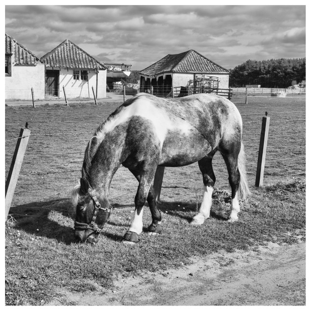
Through the gate and say hello to the cuddies grazing on the verge and walk up the track running alongside the camp, passing through another gate and an anti-aircraft pillbox to your right, up to a sharp bend to the right and look out for a signpost on the left directing you off track.


It was at this point that I had initially decided to follow the track to the coast and work up the beach, on one hand I wish that I had, although I would have missed the next stage and I would have been poorer for it.

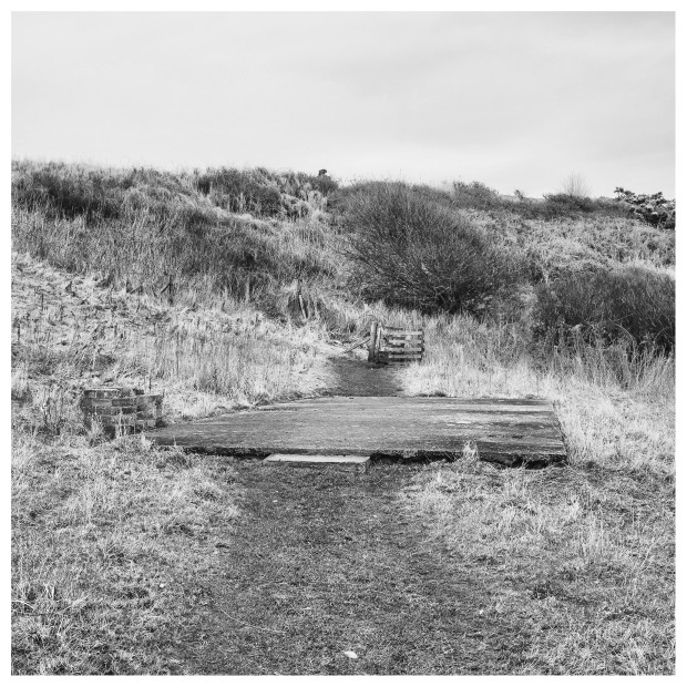
The FCP, now follows a grassy path between two fences for a short distance before a sharp turn and the first of seven board walks, going over some marshy ground. At the end the path turns to the left and heads towards Tentsmuir Forest.

The going here is splendid with a seemingly endless undulating grassy path following the marker posts to the trees and down a beautiful forest road through the trees.

In among the trees and this spectacularly broken Pine tree, like tortured horses reaching for the sky.

Into the forest proper and a pleasant walk down a overgrown forest road. Civilisation starts to make its presence known with the unexpected appearance of a good number of “dog-eggs” on the road. This dog and it’s owner must be creatures of habit to lay its eggs at more or less the same point on this road.
A flash of something at the bottom of the forest road begins to signify the beginning of the end.

All too soon this forest road joins the road heading down to Kinshaldy Beach. It’s a narrow road, it’s hard surface and seemingly constant traffic make it thoroughly unpleasant to walk upon. There should be a footpath here but there isn’t. Had I known what lay ahead I would have headed off into the forest along the Polish Camp Road and worked my way down to the coast because I really regretted walking along this road.
A mile and a half of road tedium and misery.
The Forestry Commission charges £2 per car to park at Kinshaldy Beach, they get their money easily and something spent of a footpath would have been money well spent.
Eventually you arrive at the car park, which is a “Sodom and Gomorrah” kind of place compared to the peace of the forest earlier. although I am not sure if that den if iniquity ever had a Crepe Bar but this place did.

Way marking here is non existent, turn left along the forest track and continue all the way northwards for the next two and a half miles. I grew bored of the people, bored at looking at trees and so about a mile short of the Ice House, I turned right along a path heading for the beach, which passed by the old rifle range and a Range Quadrant Control building. The metal supports for the mast that held the red flag are still by the path.


I would advise anyone walking the path to go coastal here, just go straight through the car park, onto the beach, turn left and start walking. The crowds will soon thin out and it’s far better being out in the sunshine with the sea and the sky than being in the forest with only trees to look at.
I never did see the ice house, I had seen it before and I saw something similar at Culross on Day 1, so I’m not missing much, although there is an interesting boundary stone beside the Ice House.
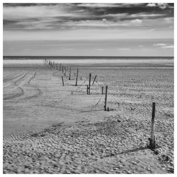
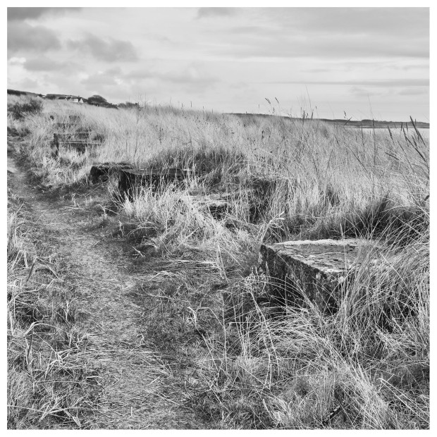
You will know that you are entering into the Tentsmuir Point National Nature Reserve when you see the fence stretching out of the trees and across the beach. It strikes me as extreme control freakery that anyone would want to put a fence onto a beach as the sea has no respect for paltry things as fences.
A gate by the waterline allows access to continue up the beach. You will hear the cries of the seals as they sun themselves on the sandbars way out to your right.
Leave them in peace as you walk up the coast.

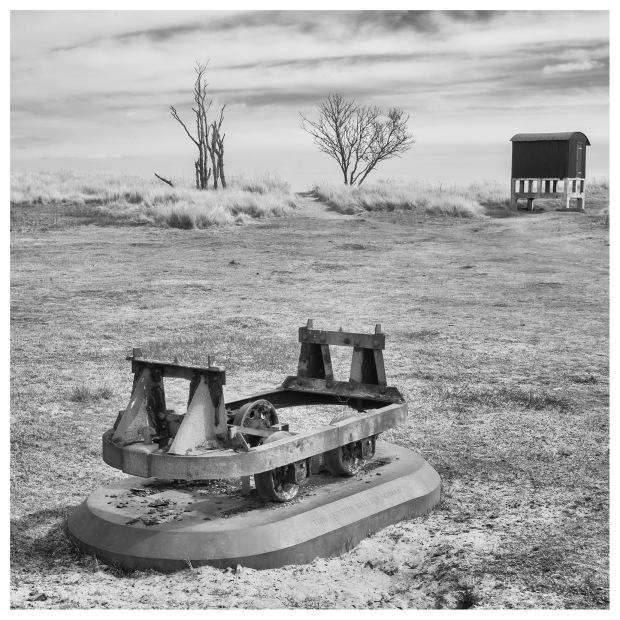
I found a quiet spot for lunch by a green bird hide up on stilts, which once was used for the gunnery range Quadrant Control building with the rusting remains of a railway target tug bogey found in the sands preserved nearby. This whole area used to be an air to ground gunnery range and the targets were towed along on these railway buggies for the aircraft to shoot at.
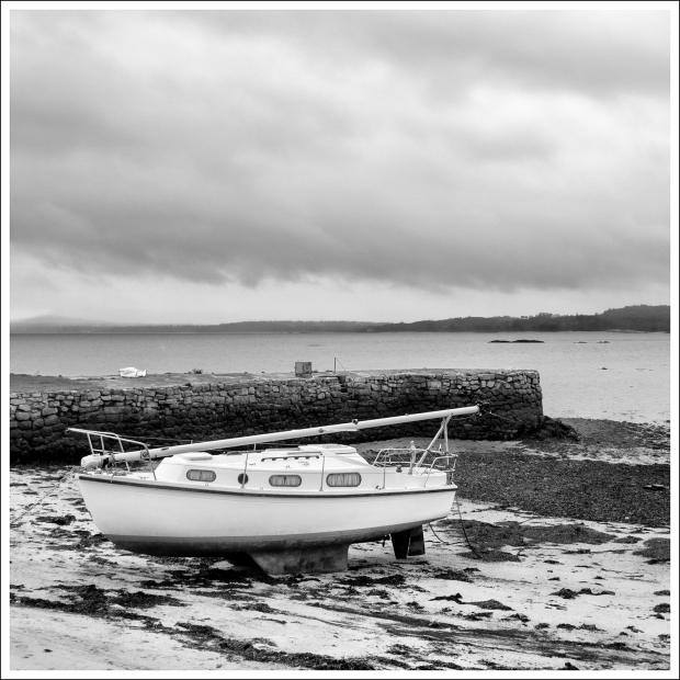
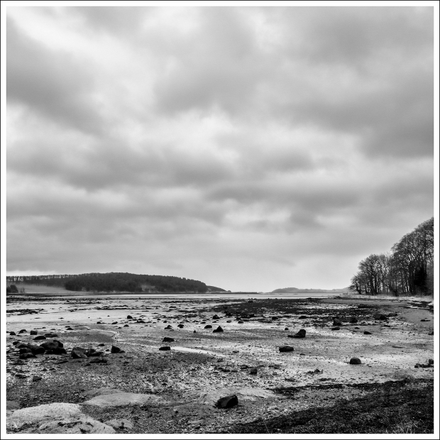
The way around Tentsmuir Point isn’t easy, the sand was soft in places with a strong, cold off-shore wind bowing the sand over ones feet and into the water but I didn’t mind it was such a pleasure to be out on the sands.
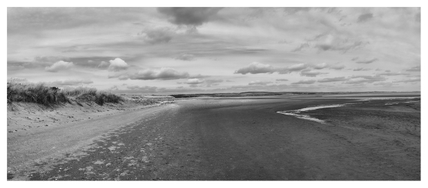
I would not have missed this for the world. Such an expanse of sea, sand and sky with the Barry Buddon range tower and lighthouse in the distance for company. The sand was being whipped over the beach, especially so when I started to near the point with the new view of Dundee in the distance.
All too soon another fence over the beach came into view and I had to head to shore to the gate through.
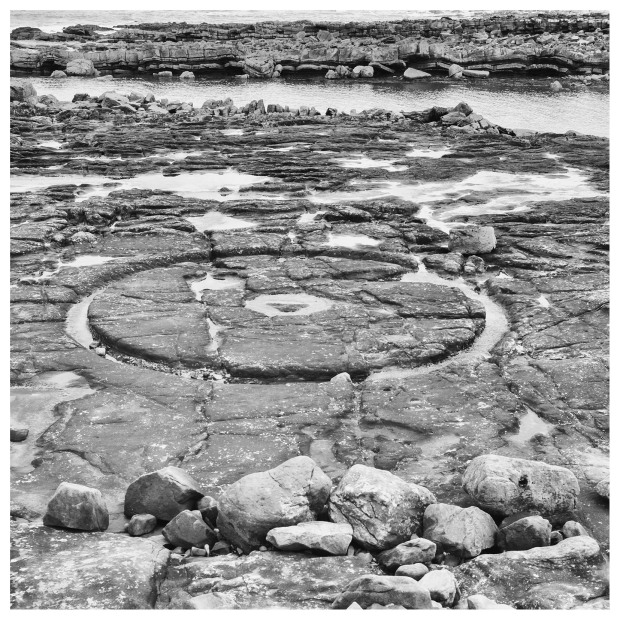
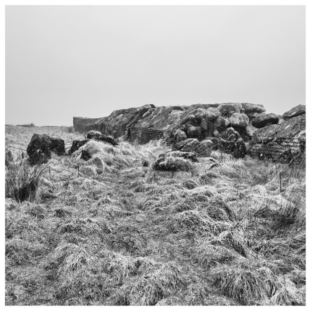
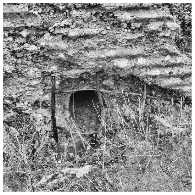
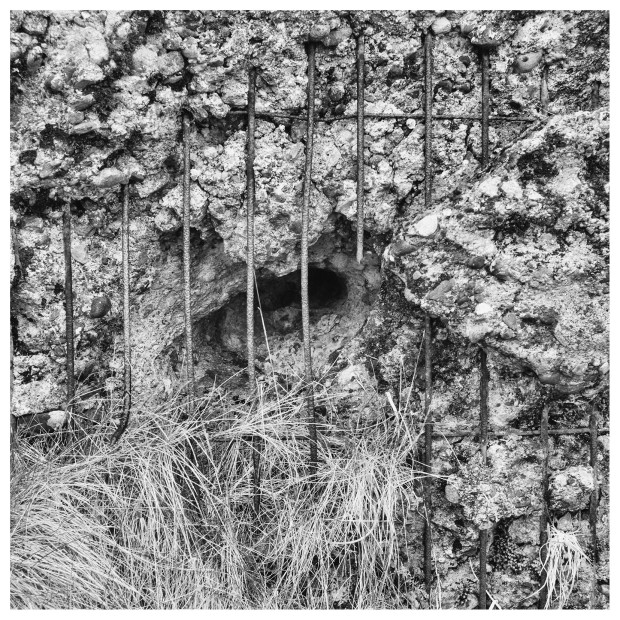
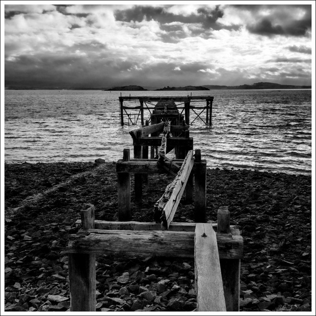
However I was in for a treat, there is a line of cubes, anti-tank obstacles. Usually these cubes were made by pouring concrete into wooden planking moulds or in this instance into a mould lined with corrugated iron. I know I’m easily pleased.
During WW2 the grown-ups were seriously concerned that Fife was a likely German location for an invasion. Funny enough it’s similar territory to Normandy, so along the coast obstacles were erected to slow the invasion down. In the case of Fife there was a stop-line farther inland where the main defence was to have been made.
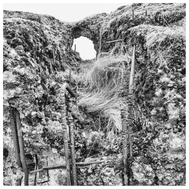
Also here, dotted all along this piece of coast are the stumps of anti-glider landing obstructions embedded in the beach. Just how a He.111 would be able to tow a glider and then return was beyond the military mind… then again 20/20 hindsight is the curse of anyone interested in history as we all know how that story ended.


I took a path running along the shoreline, a rusting pillar standing proud out of the sand is the remains of a Spigot Mortar. Presumably this would have been surrounded by sandbags it its was fired by a soldier standing upright, an exposed position during a fire fight. There may even be traces of trenches nearby.
The path heads into the trees for a short distance before emerging on the shore, where I went coastal again walking across the sand beside the row of fallen cubes.

I sort of took a short cut. Rather than returning to shore and walking though the forest, I headed for a prominent group of cubes on the shore about a mile distant. The sand underfoot was hard enough to walk upon, none too sore on my feet and a lot better than a forest road.
Drawing up onto the shore in front of two pillboxes with unusually large embrasures on three sides.


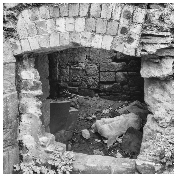
A rusting chain-link fence behind the pillboxes, surrounding what was a meteorological station. I had forgotten what this place was until I saw the Danger Explosive Gasses sign on a distinctive a tall shed. Its roller doors at either end, were used for walking the balloons out for release.
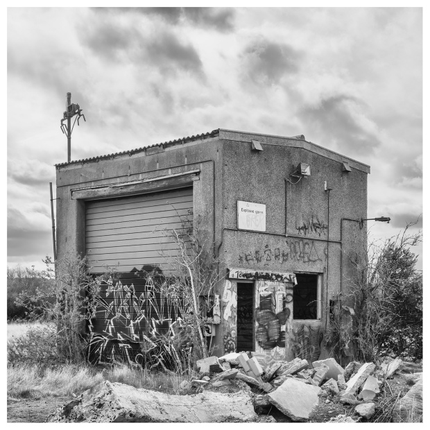
All redundant now, a victim of spending cuts and technology and now serves as a canvas for graffiti artists


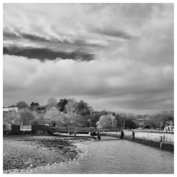
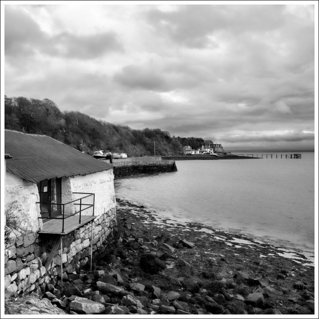
From the Met Station, it was a case of following the road through a gate and towards the houses. The FCP turns right in front of a small shop heading for a caravan site and car park. It was here that I stopped my walk for today and walked a short distance up the road to wait for my bus back to Guardbridge.
If you are going further on, there is a path that runs close to the shore heading directly to the car park and caravan site, shortening the route.
Well that’s all from me, there is only two more stage left of the Fife Coastal Path left to do but rest assured….

Fife Coastal Path – Anstruther to Kingsbarns (Part 2.)
Posted by squawking7000 in Fife, Fife Coastal Path, Historic Scotland, Photography, Scotland, Travels, Walking, Wee jaggy bits o' history on March 30, 2017
Going Coastal – Part two of my walk along the Fife Coastal Path, continuing where I left off at Crail, around Fife Ness, carrying on past Carnbo to Kingsbarns.
Cabbit in Crail
A kind of strange moment happened here, when I got stuck behind a group of people dawdling along the pavement in Crail, looking for somewhere to eat. They were undeniably visitors to the town, contrasting strongly with the kind of people you meet along the FCP and to be honest, my anti-social nature gained the upper hand here, I did not want to be near them, so it was time to get out of town. I wanted the peace and quiet of the walk, only to be punctuated by the maddening cry of the Oystercatcher rather than the cry of the maddening tourist.
The Fife Coastal Path, FCP follows the main street of Crail continuing onwards into a very wide road, which compared to the town you have just left is out of place, almost like a new town. The route goes along this broad street for a short distance before turning right, heading down to the sea.
Tides
However, because I set off without checking the tide times, I had to make this a priority. There was next to no signal on my mobile phone so I went down to the harbour to find out. I knew the water was low but in which direction was it going, ebb or flood tide?
It turned out to be a flood tide, it was coming in and there would be another four hours before high water with plenty of time to do the next stage of the FCP to Kingsbarns.
From here until St. Andrews, the state of the tide is paramount as parts of the FCP can not be done with a high tide. Especially near Cambo and Boarhills.
I knew my way about this part of Crail, so I took a footpath, which runs along an escarpment above the harbour, the old town sundial is on this path. It used to, until 1890 stand by the harbour. I wonder who turns it round for British Summer Time?

Before the age of clocks there was a simple stick in the sand and then things got high tech…
A local landmark is this turret cum summer house, which stands above this walkway, I decided to shoot this one as a silhouette.
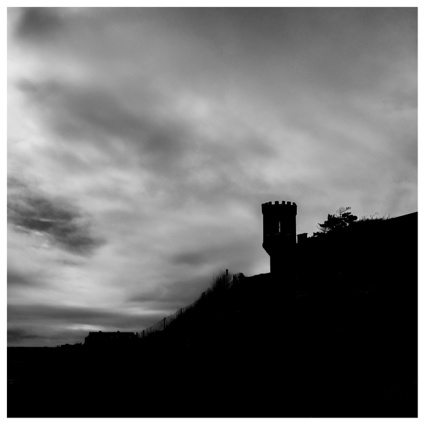
The best Summer House in the business.
The footpath descends to the shore line after the old mill and continues along the shore wall up to, surprise, surprise, another outdoor swimming pool!


This one is the most natural of all the Fife outdoor pools with only one wall being needed to contain the water.
After the pool the path continues past a children’s play park before climbing steeply up the hill to go before some houses away from the shore before heading back towards the shore.
It then continues through the seemingly ceaseless, regimented lines of a static holiday caravans.
There is a pill box on the escarpment above the caravans, it is unusual in that the firing embrasures are facing inland, towards the airfield rather than seaward, where you would think that the enemy would come from. There is another pillbox farther along the coast, again with the embrasures facing away from the shore.

Back to front
The airfield was once HMS Jackdaw, a Royal Naval Air Station used as a training base for torpedo bombers and has unusually for a wartime airfield, four instead of standard three runways. The whole airfield is in a good state of preservation including a large and unique Watch Tower.
Blissfully the road through the caravan park ends and the path restarts, following the shore and more opportunities to see washed up creels along the way.
The way forward marks literally a watershed, along the FCP. It starts out on beautifully paved paths, continues along pavements and roads and none too bad paths up to the section around Fife Ness. It now starts to get harder, less well paved and more serious in that the state of the tide must be a consideration. So gaw canny.
The escarpment to your left is in fact a raised beach. A wartime building was built into the slope, its windows have been bricked up and they don’t look like embrasures.

Straight through the hut
The FCP actually goes over possibly the foundation of a wartime hut as it passes through the Kiminning Nature Reserve. The path goes up a slight hill, where on the descent, there are a number of concrete foundations, which were possibly wartime beach barbed wire supports.
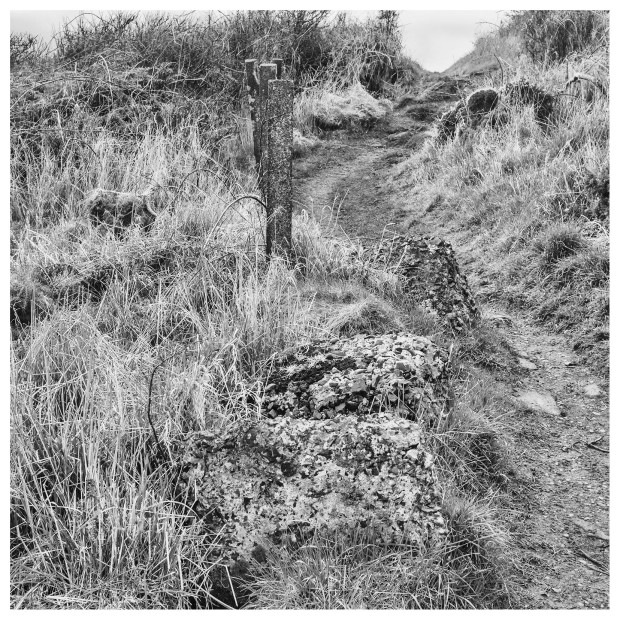
Beach wire support post foundations
I popped up off the broad grassy track onto the escarpment to have a close look at one badly cracked pillbox. It would seem that the bunker was built in two parts, the inner and an outer section, again with the entrance door facing towards the sea.


The path then starts to climb up again, through a ticket of thorn bushes, which was as good as barbed wire in my book.
There is a small headland here, according to the information board, it was used as a flour bombing target by the wartime RAF, which with bread being rationed seemed to be an awful waste of a valuable resource. However – never let the truth get in the way of a good story, right?
Bomb here
Fife Ness
At the top you will get your first proper view of Fife Ness, the former Coastguard Station, controversially closed in a centralisation cost cutting measure, depriving the service of valuable local knowledge.
The houses here, are painted in pastel colours but it can’t disguise their yucky architecture.


The Fife Ness light is inside a fenced off enclosure, at the foot of which is a pillbox, built out of local stone rather than poured concrete. It’s now a midden for plastic beach debris.


Inside can be seen one of the embrasures for mounting a Bren gun, a common feature of these bunkers.
The large rock behind the pillbox has lots of initials carved into it. Tourists or bored sentries, or the Polish soldiers who built the pillbox, who knows.
There is a small natural harbour here that was used to ship stone from a quarry below the golf clubhouse. The North Carr rocks lie off shore and a lighthouse was started by Robert Stevenson in 1840, the stone was worked locally and built onto a circular base on the rocks to the left. The lighthouse wasn’t finished and a metal tower was built on the rocks instead before the North Carr lightship was placed on station. There is an automatic beacon on station now and the ship has been preserved at Dundee.
There is a large tidal basin farther along the bay, which formed the pond for a water mill, the water wheel was turned by the outgoing tide.

Tidal mill pond panorama

Turn right before the club house
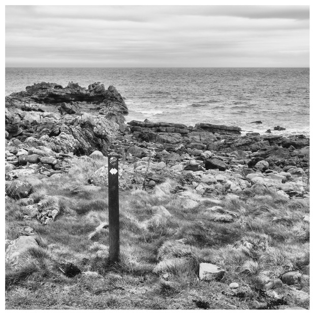
The FCP then turns right and follows a line of white posts along the very edge of the golf course with all its attendant risks of flying golf balls.
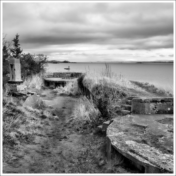
I found a rare relic of WW2 in the form of an metal observation post, lying half buried in the sand. I am not sure if these armour plate domed shelters were ever meant to be serious defensive positions or merely observation posts but their use seemed to me to be a suicide mission for the guy inside.

Constantine’s Cave is by the shore with an extensive information board, the Pictish King, Constantine was reputed to have been killed in this cave, others doubt this. Never let the truth get in the way of a good story.
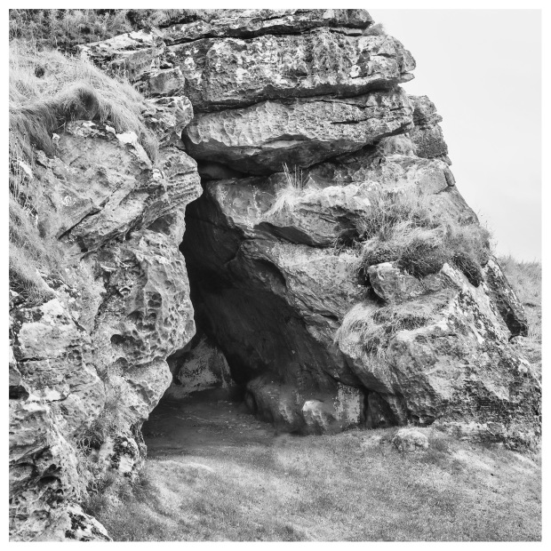
Constantine’s Cave
The old Crail Lifeboat station stands above a large beach by the golf course. I found it better to walk along the shore than to walk alongside the greens. There is another huge pile of wrecked creels on this shore.
There is a second better preserved observation post in the sand by a golfers shelter.


Shortly after this shelter things get serious. The path goes coastal with no onshore alternative getting around the headland with its serious cliff towering above. The signs direct you to walk along the coast for the next half mile or so, even though there seems to be flat land on shore.
Cambo


After rounding the headland, it is possible to walk on the field however the route is quite specific in that you walk along the shore. The cynic in me suggests that this could be a case of “Oi you, get off my land” kind of attitude by the landowner, the dumping of debris along the edge of the shore seems to reinforce this impression. The coast is rocky in places with sandy strips to walk along and all in all is not that bad walking.

Not on my land
There is a pile of concrete footings on the shore, with the rusting stumps of iron I-beams embedded in them. I think they were used for holding the strings of barbed wire on the beach.
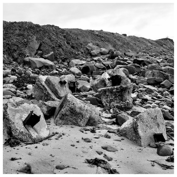
Beach obstacles
The coastal path then goes onshore along the Cambo Golf Course, which makes for easy walking along the grass and maybe not so pleasant along the paved sections. This time the boundary is marked with red posts.
At the time of writing there are notices here, warning of the suspension of the Land Reform Act access rights for August 2017 due to a women’s golf tournament. I suspect the way along the beach will still be open but again, only at low tides.
I could not feel that this whole golf course was a monumental waste of good land as here was I on a Saturday afternoon and there were no golfers on the course. I take the republican view that golf courses are a waste of good farm land. To each and their own I suppose.
Reflective mood
Kingsbarns
After the golf course, the path continues along the dunes but I dropped down onto the wide sandy beach for a better walking surface. There is a line of rocks just off shore with a metal marker post protruding from the surf, so captivated was I by this, that I discovered rather abruptly and to my great surprise that this was opposite the Kingsbarns car park marking the end of my coastal walk for toady at the 71-1/2 mile mark.


A glance at my phone was enough to tell me that I had better pick up the pace and walk up the narrow road to the village to catch the bus, which was due soon.

All’s well that ends well.
A Lion Head Public well in Kingsbarns
The bus was fashionably late, which suited me and in to time I was back in Anstruther, so all I had to do was walk along the harbour, forsaking the crowds and the chip shops, back to my car, covering the bit that I had missed in the morning.
Well that’s all from me, the next section to Guardbridge has already been walked so I’d better get busy editing the pictures and telling my story, but there’s one thing for sure….
Back to the (Atlantic) Wall
Posted by squawking7000 in Historic Scotland, Photography, Scotland, Stirling, Walking, Wee jaggy bits o' history on March 10, 2017
A Wee Jaggy Bits o’ History Special on how the British Army trained on how to crack Hitler’s Atlantic Wall on D-Day.
Hitler was determined to fortify the coastline of the occupied countries and he charged the Organisation Todt with building a series of coastal defences along continental Europe to deter invasion and the odd Commando raid.
The Allies had a problem in that they knew they would have to face the German coastal defences but they didn’t know what the best way of tackling them.
So they built replicas of the defences on a moor near Stirling and basically blasted them to bits with various types of ordinance to see what worked best.
The moorland had been used in WW1 for trench warfare training and range practice, it was fairly remote. Stirling Castle and a whole host of army bods were nearby so Sherifmuir was the logical choice for the tests.
The site is broken into four areas, the largest is a 86m length of Atlantic Wall of varying thickness, 3m in height with an anti-tank ditch in front. The remaining three sites are various styles of bunkers.
The Atlantic Wall
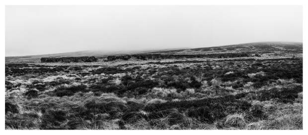
Atlantic wall Panorama
The wall may have been topped with barbed wire, although no trace of this remains and the stanchions for the wire may have been vertical when built and some scallywags have bent them all over.

The wall at its thickest
You can see the anti-tank ditch to the right of this picture
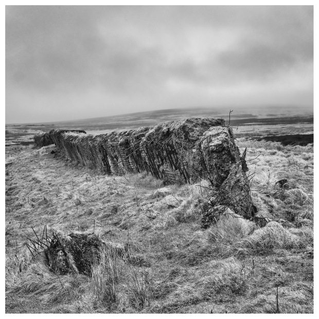
The Wall at its thinnest

The Wall as it thins down
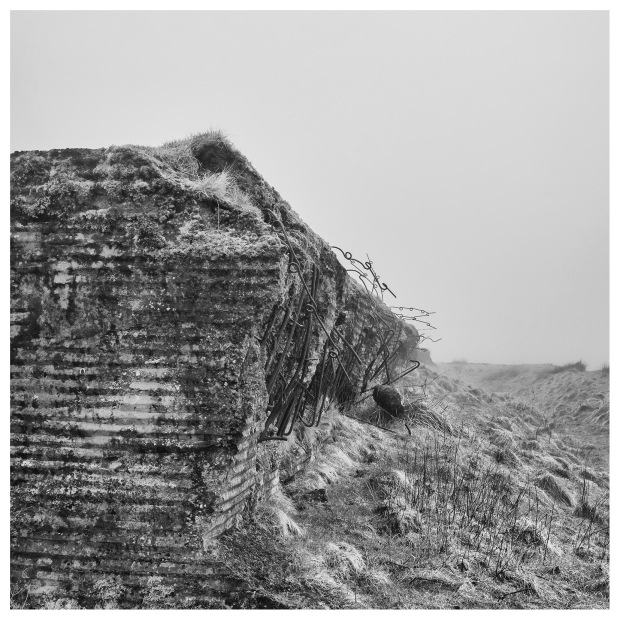
Now the blasting bits. The largest breech is this 4m section in the thickest part of the wall

Front “Seaward” side

Section and along the top of the wall,seaward to the right
The breech from the “landward” side of the wall
The wall has been perforated in various places

Rear, a large 8″ or so hole and a number of smaller 40mm sized indentations
Front. A hit near the top blasted clean through. Note the ball indentations on the reinforcing rods
Front. A low down hit from a large caliber wine bottle
Front. The projectile about 3″ hit square on and bounced out to the left. Note the tip of the reinforcing bar bent outwards

Front. A 3″ hole clean through. Note the ball marks on the reinforcing bars and the bent bar to the right.

Front. A tunnel with damage to the top of the wall

Rear. The back of the wall has been beveled by something. There may have been a door or a blast wall here at one time.

Rear. The end sections of the wall have been totally destroyed.
Bunker 1
This bunker was built using lessons learned from the German North African campaign. The bunker has two firing platforms on top and a shelter in between.
No real damage can be seen to this bunker, the front or seaward side has an earth embankment in front of it and there’s certainly no damage to the landward side.

The top of the Tobruk Shelter with the seaward side to the left, two firing positions on top and two entrances either side
Fife Coastal Path – East Wemyss to Elie (Part 1.)
Posted by squawking7000 in Fife, Fife Coastal Path, Historic Scotland, Photography, Scotland, Travels, Walking, Wee jaggy bits o' history on March 7, 2017
Another instalment of my Blisters or burst “Going Coastal” blog as I walk along the 116 mile Fife Coastal Path, between Kincardine on the Forth to Newburgh on the Tay.
Photography.
I have slightly changed my picture style. The previous pictures had a soft, dreamy look to them almost verging on a near infra red type picture and they seemed to be suffering from over exposed highlights. The pictures were fine up to the point the monochrome conversion process started after that they seemed to loose details in the brighter areas so I’ve done a bit of digital dodging to protect the highlights a bit more.The lens on the X-Pro1 was changed to the 21mm (50mm equivalent) and I didn’t really miss the wider angle lens.
East Wemyss.
It started out to be a miserable morning at East Wemyss, raining on the drive over and it was threatening to rain again as I parked my car up close to the semi-ruined St Mary’s by the Sea church.
Quite a bit of work has been made to build up the sea defences here, with the result of a nice path along by the sea wall. Quite soon I came to two monuments, the first one commemorates three fishermen who died in a boating accident August 2015, while out fishing. Once again illustrating the old saying that behind every fish landed is a widows tear.
The second monument commemorates Sir Jimmy Shand, who was born not too far away from the memorial. A great accordion player and band leader who never forgot his roots but ended up living in Auchtermuchty and was buried there.

Monuments, East Wemyss
Wemyss Caves.
The sea wall ends at a buddist garden and a short distance from that is one of my greatest “roundtoits” The Wemyss caves with their enigmatic rock carvings. The caves are only open on a small number of days through the year, so maybe one day I’ll be able to see them for myself. There are a number of information boards by the road before you get to the end of the sea wall on the caves and their carvings.

Wemyss caves
The nesting site of the Fabulous Rock. Curious as to why anyone would want to leave stones in this hollow.

Rock Nest
The path then climbs away from the coast going uphill to the ruined 14th century Macduff Castle…

Macduff Castle
…with it’s bijou 21st century drinking den in the basement.
Bijou Drinking Den.
There are a number of 17th century gun loops along the wall by the path, I don’t know whether they were for decoration or had a practical purpose in repelling attackers. This is the only outer wall that remains.

Gun loops, Macduff castle
Buckhaven.
The path continues along the side of the cemetery to join up with a disused railway line heading for Buckhaven.

Old railway line path
The going here is good with a nice view over the Forth to the southern shore. There may be a wreck just off shore as there is a yellow marker buoy just off shore in the bay.
For some reason the path climbs up a flight of steps to join another railway line as it enters Buckhaven.
There are a number of local interest boards set out on the grass beside the path, you can take the short cut by crossing the grassy area to the right or continuing along the FCP to come to an archway for another path to the “A955 and The Bird Scheme.”

Water Baulk and the Bird Scheme Path
Before you is an impressive mural painted on the fence, go up to the mural and turn right and follow the road.

Mural, Buckhaven
There are a number of local history points along this road, to look out for.
Without a doubt Buckhaven must have been some place in its day. Unfortunately those days are long gone but you can get a feel for the glory days just by the size of this local Co-op on what is a dead end road. The folk must have had the money to shop here indicating prosperity, the shop opened in 1868 and closed in 1994.
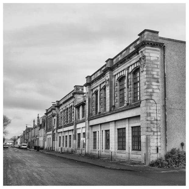
Old Co-op, Buckhaven
It would be an act of self denial to say that the walk through Buckhaven and Methil is a pleasant one but there are things to see…
Like this wane trapped behind the door of this craft butchers.
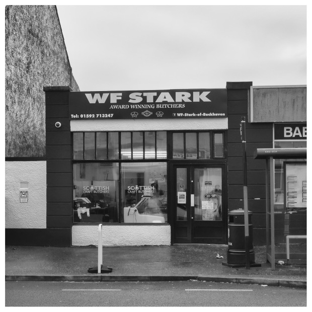
Wane trapped behind the door
Like the Mother Ship. Stewards of Buckhaven have been pie champions off and on for years, so I stopped by for a Steak Pie and a doughnut, not your wishy-washy modern baked kind but a traditional calories be damned fried one and good it was too.
The Mother Ship
The road comes up to a junction and you turn right. It should be said that way marking could be better here. There has been an outbreak of the new stainless steel lamp posts here, which has probably removed a lot of the way marking stickers. It is nice to be reminded that one is still on the correct path.
At the junction is a shop that just looks wrong. It sells electronic goods but was built for a different purpose, my guess is a traditional chip shop / cafe kind of place.

It once was a…
Methil.
Further down the road you come to the nondescript modern Randolph Wemyss Memorial Hospital and then after that the old hospital, rich with the architecture of its day, looking grand with its clock tower and stone carving, proudly declaring that it was built in 1908.

Randolph Wemyss Memorial Hospital
On the other side of the road the view is dominated by the massive experimental wind turbine operated by the strangely titled ORE Catapult company in what was the RGC Offshore Construction Yard, who built massive platforms for the oil industry in the 1980s. Today it is The Fife Energy Park.

Wind Turbine, Methil
The road comes to a four way junction, the FCP isn’t well way marked here, you turn right and head down hill. Just before you do have a look among the trees to your right and see the top of an underground command bunker that controlled a submarine mine field off Methil harbour. The entrance to the bunker has been filled in and would make for an interesting visitor attraction. These bunkers are fairly rare, certainly it’s the first one that I have seen.

Command post

Armour plate shutters were here
The FCP heads down hill to a roundabout, cross the road before you get there and follow the footpath along side the Energy Park. Over on the right is the old Methil Goods Yard. The station is now being used by a removals company.
The road comes to a roundabout, go straight on, into the quiet road ahead, you can follow the road to the right, they both end up at the same point but the ahead route is quieter and there’s more to look at along the High Street. Admittedly this isn’t the best shopping area in the world, times have changed in Methil and things have got harder for the folk that live there.
I had a very short glimpse of a poacher at work. A Sparrow Hawk was perched on the fence of a house waiting for a small bird to come to the bird feeding table, I managed to get one, pathetic shot of it with my little camera, I’ve even pointed it out for you!

The Poacher
The High Street will eventually join the bypass alongside the docks. I crossed over to the dock side of the road, following the road all the way to a roundabout in front of a Shell Filling Station. Turn right and cross over the Bawbee Bridge, proudly opened by none other than the Rt. Ho. J.S. Maclay MP, Secretary of State for Scotland, 1st November 1957.
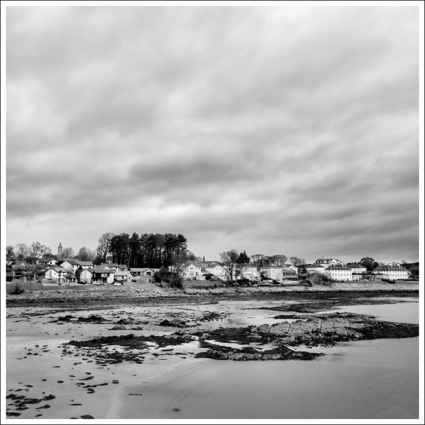
Leven.
Continue on the footpath, passing the Swimming Pool, until you come to the river, which just happens to the outfall of Loch Leven.
Leven outfall
You are now in the resort town of Leven. Strange how things go, I came here as a child in the 1960s and had a great time.
You now have the option of continuing along the promenade or “Going Coastal” along the beach. I opted to go coastal, with a photo of the oil rigs that have been my offshore companions all the way up from East Wemyss to my right.

Three Rigs, Leven
I shot this couple trying to get the shipping forecast by listening to a sea shell. I saved them the bother as I had just picked up one earlier and gave them the Forth report. They already had the one for Dog-ger.

The Shipping Forecast
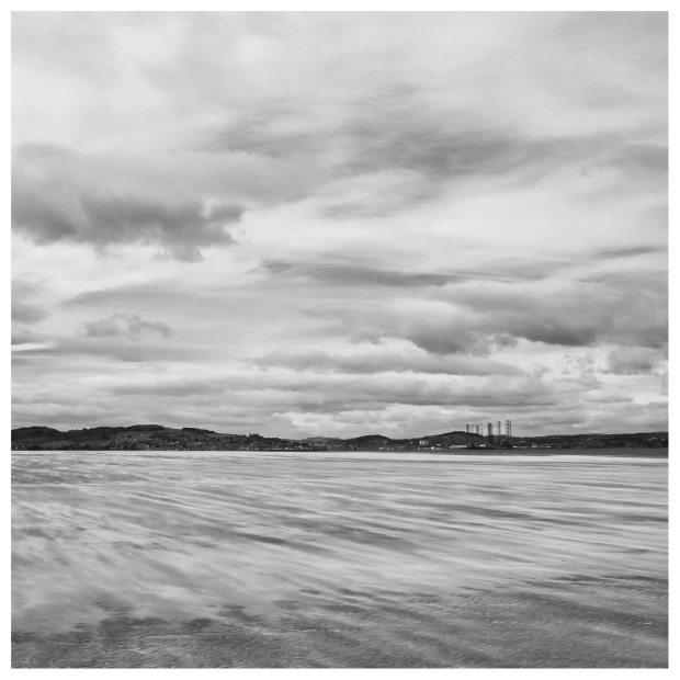
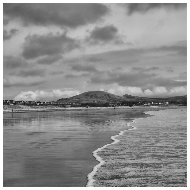
The way ahead is dominated by the volcanic mound of Largo Law, one of a number of volcanic outlets linked to East and West Lomond.

Leven Beach panorama
This area was also a supposed likely spot for a German invasion during WW2 so the Town Council hid all the deck chairs, mined the beach, strung out the barbed wire and erected some anti-glider poles in the sand, some of which still survive.

Anti-invasion obstacle
I thought I found a live shell on the beach but it was a dud, although I don’t know if that was its name.
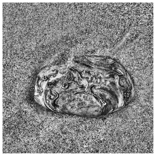
Shell
I thought that I would go closer to the water to get a shot of the surf and the Law, so checking the line of foam on the beach I stood by it only to discover the “seventh wave,” which shot past the line of foam and over my boots. The things that I do for a photo.
Wet feet
A small burn crosses the beach and it’s not much of a problem to charge on and cross at a wide shallow bit. There then follows a long pleasant walk along the beach, past some holiday caravans towards Lundin Links.

Daft Dug, Lundin Links
One last look at the oil rigs
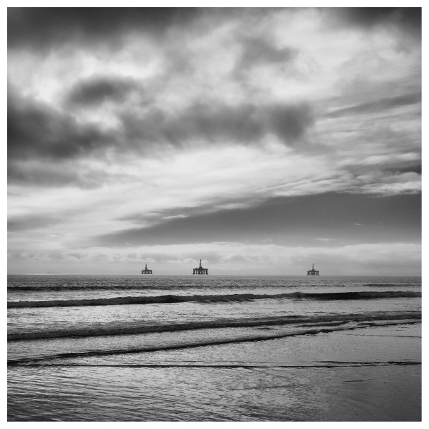
Three Rigs, Lundin Links
Continue up the beach until nearly at Lundin Links to another burn crossing the beach, then head ashore as there should be a FCP sign on the sand dune. Go up to the sign and cross the burn by the little wooden bridge. There’s an XL sized cube, which blocked the burn from invading German tanks.

Big cube
There are more cubes in the sand along the Golf Course.
Cubes in the sand
Lundin Links.
The way ahead isn’t very clear but look both ways for golfers and golf balls, then follow the little burn inland heading towards a sewage treatment plant and onto a dirt road. Turn right here and head to the houses, and follow path beside the golf course. The road comes to a junction and the FCP goes off to the right towards the Club House.
If you fancy something to eat, then the small cafe at the Homelands Trust on the right is recommended. It’s well priced and the service is very friendly, although only open during lunch hours. My plan was to stop at the hotel in Largo but I am really glad that I stopped at the Homelands Trust cafe.
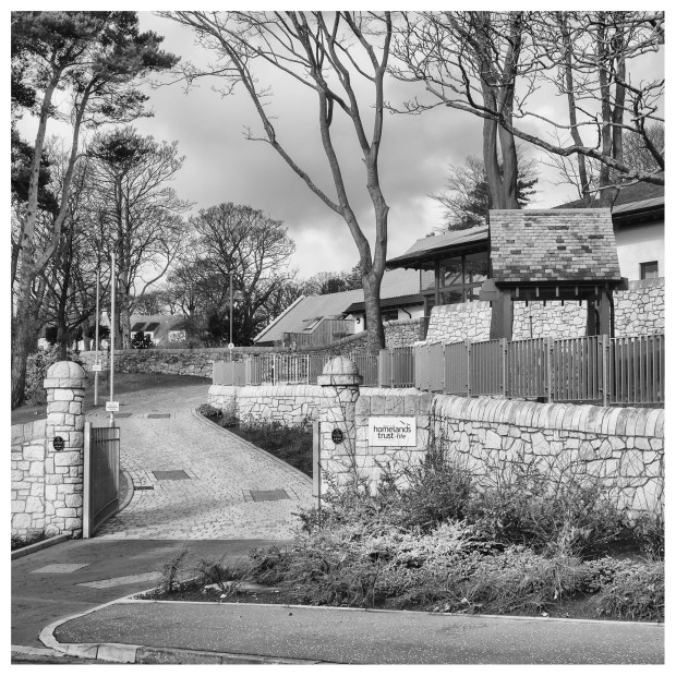
Homelands Trust

The view back to Leven
My original intention was to walk as far as the car park at the end of Lower Largo and get the bus back to my starting point but I was feeling so good and my feet hardly hurt at all so I decided to continue on to Elie and this brings me to the end of part one… but there’s one things for sure….

Fife Coastal Path – North Queensferry to Burntisland.
Posted by squawking7000 in Fife, Fife Coastal Path, Photography, Scotland, Walking, Wee jaggy bits o' history on February 21, 2017
Another installment in my “Blisters of burst” blog from the Fife Coastal Path (FCP). This time, I over done things, with what turned out to be a 14 miles walk… Put it like this, if I was the USS Enterprise: I would have dropped out of warp drive by Dalgety Bay. On impulse power by Braefoot Bay and down on batteries by Aberdour… needing some Red Bull Dilithium flavour to get me back to my car at Ferrytoll.
The plan was to park the car at the Park and Ride at Ferrytoll, walk down to North Queensferry (1 mile), then walk the 9 miles to Aberdour with the option of three more miles, to Burntisland and get the bus back. Well that’s the plan anyway,
Setting off from Ferrytoll I was looking for the Admiralty Stone that I had seen on previous visits. These stones marked the boundaries of the MoD properties. They seem to date from before WW2 maybe even earlier, anyway Ferrytoll is being drastically modernised and the stone has been removed and placed on a palate and not only that but there’s another stone. Both are marked with an anchor symbol with numbers, 6 and 7 with arrows on the top denoting the direction of the boundaries. No doubt they will placed in a suitable location when all the work is done.

No.7 Stone, Ferrytoll
My route to North Queensferry was an easy one although not a pretty one alongside the A90 approach to the Forth Road Bridge. It’s a shared used footpath with bicycles, that’s all fair and well except for the “roadie” who came up behind me, nearly putting himself in the weeds rather than shout or even slow down as he approached. Lets say that I insulted his parentage and likened him to a part of a female anatomy…
At the foot of the Bridge is the commemoration stone, unveiled by HM Queen, September 1964 when she opened the Road Bridge. Hell the Bridge is almost as old as I am!

Forth Road Bridge, opening stone
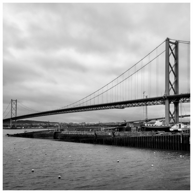
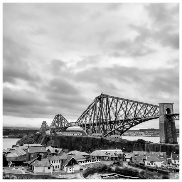
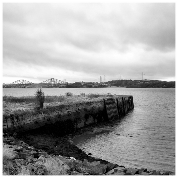
Just beyond the stone, a set of steps leads down to the road and the FCP. I followed my nose, which led down to the river and a new vantage point for me under the bridge. I set the camera on panorama mode to get all three crossings: Rail, Road and the new Queensferry Crossing in the one picture.

Three bridges panorama

Underneath the Road Bridge
I found an interesting piece of carved stone behind a wall, it was just lying there!

Carved stone
Down at the old pier I discovered the site of the old railway that took foot passengers off the ferry. A similar railway operated from Port Arthur (at the opposite end of South Queensferry) on the south bank and is now a footpath. The cutting for the line on the northern side has been filled in and houses are built upon it, although the tunnel under the hill must still be there, the railway line joined the main line at Inverkeithing. The line was later re-used for the naval base at Rosyth.

The site of the North Queensferry station
The ferry slipway
At the foot of the hill where the road is closest to the river is the house with the sundial on the wall. It and it’s neighbour dates to the 1700s.
Sundial
On the opposite side of the road is a public right of way, follow the steps down to Willie’s Well. There’s a plaque dating to 1937, although the well is a lot older than that. The well was once lit but now it is on need of some restoration.

Wullie’s Well
Following the road right to its end at the original Town Pier and the old lighthouse, which was open. The entry free was a donation. The stairs are narrow but the view is interesting. I never realised that the funny thing on top of the cupola was actually a chinmey.

Inside the Town Pier Lighthouse
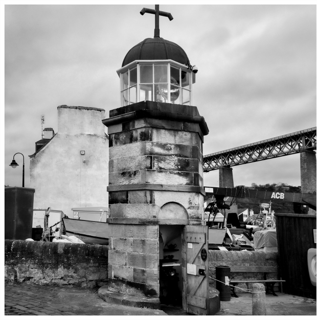
There’s something that cries out “39 Steps” to me every time I see the Albert Hotel and the Railway Bridge, although the hotel had no part in the film. It must have seen a lot of comings and goings in its time.

Albert Hotel
North Queensferry is absolutely knee deep in history and you can get seriously distracted with all the nooks and crannies, such as Post Office Lane. I think the post office was in the building which is now a restaurant. The smell from the all day breakfast was tempting, VERY tempting.

Old Post Office Lane
Backtracking to the Fife Coastal Path is the Lions Head Well from the lions head on the fountain head. It has some interesting iron work set into the wall beyond. One motif looks like a couple having an argument or fight.

Lions Head Well
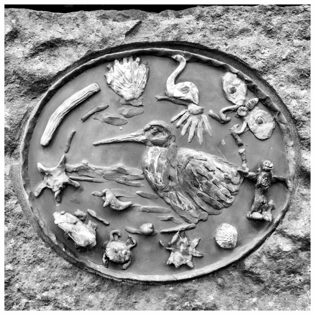
The path goes up the side of Carlingnose Point under the Rail Bridge, as it does there is a set of seven brass plaques set into the wall looking like they were made by local school children.
Farther on up there is a good view of the Rail Bridge.
 There’s a small air raid shelter just off the path slowly surrendering to the brambles and local scallywags.

Air Raid Shelter
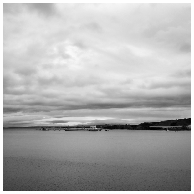
Over the other side of the Forth is the oil terminal at Hound Point, the ships engine could be plainly heard across the Firth.
Hound Point
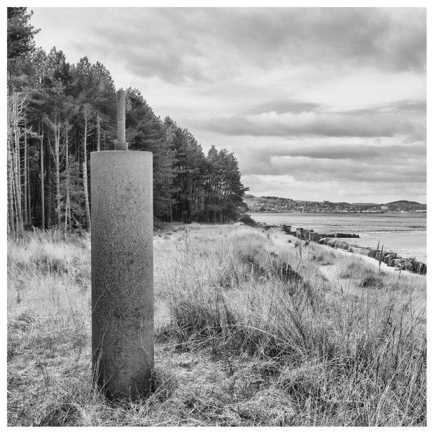
There is a quarry at the top of the point, with tie-downs for barrage balloons set into the quarry floor, they lie to the left of the path.

Tie downs
A tree at the base of the escarpment has a plaque remembering a 10 year old dog.
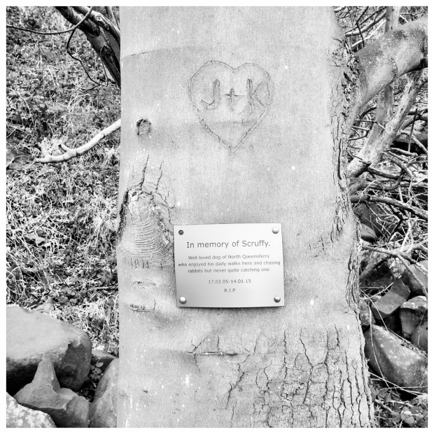
Scruffy
The view from here is quite good, overlooking a ruined pier according to an information board, constructed for the Army during WW1 for landing supplies and ammunition. One source has this as a pier for a mining station.
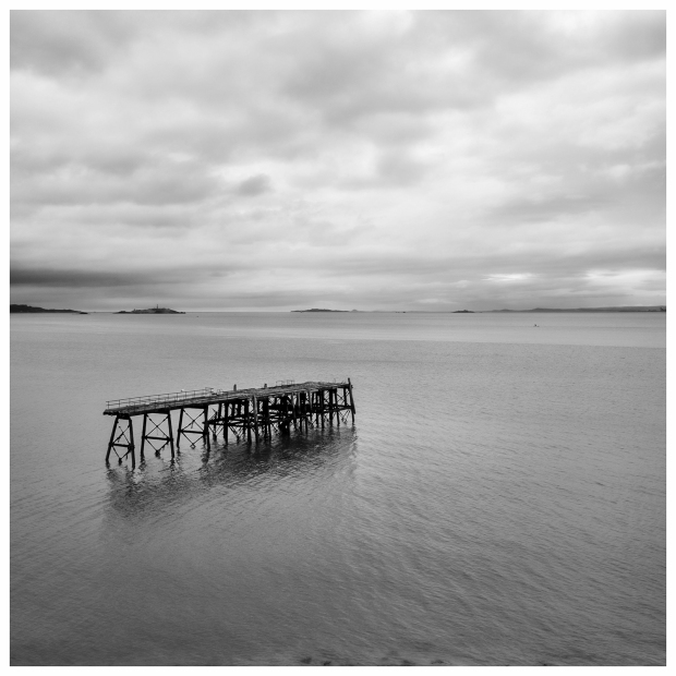
Pier
The path makes its way down towards the shore along the army road passing what was the head of the Army pier and it eventually comes to Port Laing, a sandy bay, quite out of place with the rest of Carlingnose Point.
There are three houses here. There is a small memorial plaque set into the concrete near the northernost house commemorating the sacrifice of Lt.George Paton, who gave his life to save his men when a grenade was badly thrown, June 1916. One source states that this area was a WW1 seaplane base.
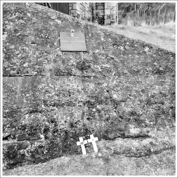

Port Laing
The path becomes a rough road as it makes its way towards the neck of the small bay at Inverkeithing and eventually passes behind RM Recycling. Many a famous ship met its end here. They haven’t broke a ship in years most of it’s business comes from other metal recycling.

Ship breakers yard
My eye was caught by a small concrete hut partially buried in the trees on the opposite the scrapyard, it looks very much like emplacements and magazine lockers for a light anti-aircraft battery.

Anti-Aircraft gun site?
The FCP continues on the footpath up to a large building on the left, which was dormitory accommodation for Rosyth Workers. Under the railway bridge and up to the main road, which was for many years the Great North Road from the Queensferry to all points north. Turn right and head up the hill to Inverkeithing. There are some interesting buildings in the town, one notable one is at the top of the hill being part of a 15th Century Franciscan Friary, head for the small gate behind the Friary close to the Inverkeithing Civic Center, where the extensive ruins can be seen at the foot of the garden.


Friary
You pass by the front of The Half Crown Public House with a plaque commemorating Samuel Greg, who lived here at one time and became an Admiral in the Russian Navy.

The Half Crown
The town’s Mercat Cross can be seen just beyond the Friary, it is one of Scotland’s oldest Mercat Crosses, dating to the late 1300s.

Mercat Cross
Thomson’s Lodging is a yellow lime stone washed house just down the hill from the cross with an interesting lintel above the doorway.

The inscription is in Old Scots.

The Tolbooth Tower and Town House is at the foot of the road.

Old Tollbooth
Turn right and head down hill for a short distance. You will cross a disused railway, which was where the line from North Queensferry tied into the main line. Before you turn right, look down the hill, there is a small stone pillar which marked the eastern gate of the town’s wall.
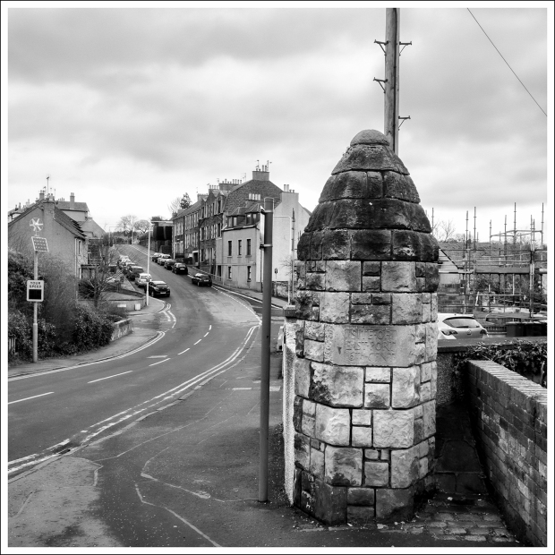
Site of 16th Century East Port
The FCP follows the road down towards the shore passing a Doocot that’s been converted to a house, the addition of the semi-circular extension for a spiral staircase is a nice homage to Scots architecture of the time.

Doocot dun up
The path goes along the front of houses then around the back of the Stevedore business to Prestonhill Quarry, which described before.
Prestonhill path towards St. David’s Bay
The tarred path continues to St. David’s Bay the last part of the Dalgety Bay housing development. In olden days it was a coaling port, supplied by a horse drawn wagon way from the Fife hinterland around Crossgates.

St. David’s Bay
There now follows a dreary three miles or so as the FCP makes its way past the town it is true the route is punctuated by a good number of interesting places but it’s no fun plodding by the houses.
The FCP comes to a small promontory with a WW1 gun emplacement at Downing Point There were two 4.7inch guns mounted on promontory with a fire control point between them. The name J CODY 1915 is written into the cement at the top of the pillar. There is also a concrete datum point set into the top with which looks like thumb prints in the cement.

Downing Point battery
Two searchlights were sited at the far end of the point, now marked with what looks like a channel or submarine cable marker.

Search light location, Downing Point battery
The camp for the battery was in the woods and now built over by the houses.
You will see the cupola of the Mortuary chapel of the Earls of Moray, dating to 1731. The way to the chapel is not marked, either follow the FCP along the high hedge, turning left at the top or turn left before the hedge and there is a path through the houses beyond.
Chapel on the left, Donibristle House, right

The houses here are expensive but look dire with their yellow bricks, which are totally out of place and more in keeping with the leafy suburbs of a major English town than a Fife new town.
The FCP passes in front of the wings of the old Donibristle House the centre piece beyond is a modern reconstruction. You can walk up to the beautiful ironwork between the Wings then re-join the FCP by the stairs down to the harbour.

Donibristle House
You can walk past or through the Dalgety Bay Yacht Club to arrive at the old Stables for Donibristle House. I chose to walk along the shore with its softer grass compared to the hard pavement.

Donibristle House Stables
You will have by this point seen the Danger Radiation Signs around this part of the shoreline. Radioactive particles have said to have originated from the Radium used to paint the dials on aircraft instruments, dumped from the RN Aircraft Yard at Donibristle a little way up the hill from the bay. Either way Radiation Bay is quite an extensive contaminated area and will probably never be cleaned up.

Radiation Bay
The path does through some woodland by the shore before heading inland and up a slight hill to St.Bridget’s Church, which dates to around 1200 although the buildings are 18th century. The church served the Dalgety village which had disappeared by 1836. I left the exploration of the church for another day as it was the playground of some children.

St. Bridget’s Chapel
The FCP now heads away inland up the hill before turning right onto an avenue which goes all the way to Aberdour, passing the Braefoot Bay Marine Terminal, where I recognised the wail of the B-C-01 compressors, signifying that all is well with my pension fund.
Braefoot Terminal
The FCP goes under the access road with some interesting murals. It’s a good idea to go under and not across the road. The guys come belting up the hill and get little notice of anyone crossing…. 30 years worth of experience talking here!
The FCP passes by St.Colm House and makes its way along Beech Avenue.

Cyclist, Beech Avenue
Past the golf course.

Aberdour Golf Course
To Aberdour, passing through what’s left of a pair of iron gates, turning right onto the main street, where I stopped for lunch at the Aberdour Hotel where I had a nice long rest and a fairly enjoyable meal.

Aberdour Hotel
To be honest, I was footsore by now and it wasn’t a great idea to continue on to Burntisland but I did. My pace had dropped considerably and I was more or less hobbling along.
There was a nice Georgian enamelled post box sign by the post office in front of the hotel.

Georgian post Pox
Aberdour Castle is worth exploring if you have the time, there’s a path by the train station.
Anyway I followed the FCP as it turned right, off the main street down to the Firth to a nice wee beach and the 18th century pier by the boat club.
Aberdour Yacht Club
The path clings to the side of a hill as it makes its way to Hawkcraig Point. It meets the road and then double backs on itself climbing up the hill by way of rough stone steps.

However it’s well worth making the short diversion to the point. There’s a nice seafood restaurant here and the site of a WW1 seaplane base, of which noting survives. It is thought that a hangar existed on the grass in front of the house.

Site of the sea plane base
Looking straight out to Inchcolm
The path up the hill will take you to the top and great views over the Firth. The path descends down a long set of steps towards two curious red and white painted pillars. They puzzled me until I worked it out that when seen from the Firth they will be in alignment when entering the channel for the Barefoot Marine Terminal.
Channel markers
The area around here was the site of HMS Tarlair and was used for hydrophone research during WW1, nothing remains but the bases of a few huts.
There is a curious structure built on the rocks looks like the base of a hut but it’s use is beyond me.

HMS Tarlair
The FCP then follows a road and numerous car parks to the Silver Sands. You can get a bite to eat here if you are that way inclined. I hobbled on past the restaurant to the far end of the park and the path to Burntisland.
The way forward
Years ago, when I cycled this way and it was a muddy track and now it is tarred in the flat sections and a good whinstone path in the uppy and doony parts. 
It’s nice and pleasant walking along by the shore until the way goes under the railway into the woods.

The trains will pass quite frequently breaking the monotony of the path. A small cave is up in the trees but I was too tired to go scrambling up the steep incline to go investigate. Maybe another day.
The path passes a quaint waterfall encrusted with lime deposits making an interesting sight.

There is a small harbour to the right, with a derelict boatshed with the title Kinghorn Yacht Services, strange as it is no where near Kinghorn. The harbour was built in the early 1800s to ship lime from a quarries farther uphill.

There must have been a bridge over the railway to a loading point or siding, however only the foundations still survive.

The skyline is dominated by a radio mast that carries the signal from Radio Forth, the original location for this mast was close to the Braefoot Gas Terminal, moved for safety reasons. Warning signs about the radiation danger are fixed to the fence. There’s nothing like being cooked to music.

The last time I was on this path it was a red muddy mess, there was an aluminium works to the left, and the bauxite ore got washed down hill and onto the path. Everything in Burntisland seemed to be red, however the works closed down and the site is now used for houses and we have a fine path to follow into Burntisland.
I put the camera away at this point as it had started to rain at this point, growing steadily heavier as I made my way up the hill to the right and down along the high street.
I hobbled as far as the car park at the far end of the street, which will be my starting point for the next stage.
All that was left for me to do was hobble back, almost all the way along the High Street to a bus stop where I caught the No.7 bus back to Inverkeithing. Planning failed as this bus did not go to Ferrytoll leaving me with another mile to walk to where my car was parked.
All in, and I really was all in, I must have walked 14 miles and to be honest it was too much. However that’s the first 29 miles of the FCP completed and …
A sunny day on Moncrieffe Hill
Posted by squawking7000 in Dog walk, Perthshire, Photography, Scotland on February 17, 2014
Oh dear, where do I begin?
Fin, the Photographers Nightmare and my faithful Labrador is showing his age, he’s 12 1/2 years old now and is no longer up for the duration of walks that we used to do and I have to admit that I miss our morning walks along Hatchbank Road and the photo opportunities along the way. Probably just as well as the weather in this part of the world could only be summed up in the good Scots word – dreich!
It’s been miserable here lately, if its not blowing a gale then its raining hard and sometimes its both! This winter, we have hardly had any snow or hard frosts, so generally its been a mild with little or no photo opportunities and even less for photographing things with wings.
Yesterday was a little different, a nice piece of blue sky and some cold winter sunshine was enough to get me out on the bicycle to do a 23km run, that’s 14 miles in old money up through Kinross and out into the countryside then returning back along the Loch Leven heritage Trail. I realised that was a mistake by the time I was about a half mile onto the trail. It was too busy with other walkers, it brought out the grumpy old man in me and I got off the trail and continued the rest on the road.
The trail is due to fully open in the Spring, going all the way around the Loch for about 14 miles, so with the prospect of the lighter mornings I will be able to get out earlier and hopefully get the whole trail more or less to myself, willingly sharing the path with the other die hard eejits and dog-walkers.
Anyway, it was such a nice day that my darlin’ and I decided to go for a walk and to cut a long story short we ended up on Moncrieffe Hill, to the south of Perth. It was a good decision as the trees shielded us from the wind leaving us with the muddy, waterlogged forest roads to contend with and an hour or so later we found ourself at the site of the Iron Age fort at the top.
Photos?
Of course there were photos.

Trees 1, Moncrieffe Hill
My interest in ICM photography, Intentional camera movement, as opposed to blurry photos shot by mistake has been rekindled lately. Unfortunately, time was of the essence and my darlin’s patience finite so I did not work the shots like I should have done. Maybe another day…

Blue skies and bare trees
These must be Pole Pines, they are certainly straight enough.

The view from the escarpment
I had some doubt about where the forest road was leading us, so we went up a short escarpment and scree slope. My darlin’ did not really appreciate the climb but it reminded me how much I enjoyed hillwalking and how tender my knees were from the morning cycle. Still the view was worth it.
The view at the top, looking over towards Perth was fantastic so I had a go at a pano. This was the first panoramic photo that I have made in a while.

Perth Panorama
You will be able to get a better look, if you select the image. You will see that things were not all rosy as the weather was kind of nasty looking over the Sma’ Glen in the middle left distance. Still not bad for a small camera. This would be a great location for a Gigapan Panorama but that won’t happen without a small lottery win first!

East Lomond, through the trees
On the way down I glimpsed this opportunity, where the trees formed a natural frame to East Lomond in the distance.

One man and his darlin’
That’s it from me, all I have got left to do is clean the walking shoes but there is one thing for sure….

Fell off the face of the planet – AGAIN!
Posted by squawking7000 in Dog walk, Kinross, Photography, Scotland on October 5, 2012
Déjà vu from French, literally “already seen”, is the phenomenon of having the strong sensation that an event or experience currently being experienced has been experienced in the past. So I fell off the face of the planet again. My excuse for such an act of carelessness is that I have been working quite a bit over the past seven weeks.
My employer completely shut the refinery down where I work for its eight yearly period of maintenance and upgrading and by next week the refinery will be back in production turning out Ethylene by the ton, ready for the European plastics industries do do whatever they do with the stuff.
September was understandably a very lean month.
This one was shot as I left work after a night shift at the back of six in the morning. The wind turbines have just started to be erected and almost a month later the first two have been commissioned and generating electricity. The turbines are an emotive thing, you either like them or you loathe them however they are something close to a Scots heart in that we are getting something for nothing, well almost. If push comes to the shove I would rather have one of those blighting my doorstep than a nuclear power station.

Loch Gelly turbines at dawn
A keen eye will see that Shell’s elevated flare is going full out, that’s the ethane that never got to market….
First thing this morning and I was treated to a rather spectacular sunrise.

Pre-dawn glow, Benarty.
This was an HDR image, which ended up being processed for just the lighter tones, leaving the hill in shadow, going for the silhouette rather than the detail.
It is so true what they say about the scottish weather, waith five minutes and a different one will come along. The next time that I looked out the window the golden glow had gone to be replaced by fog.
The fog persisted for about an hour before it burnt off, giving me the chance for a monochrome of the nearby Cleish Hills.

Cleish Hills, Monochrome
I lost a wee bit of the detail at the top of the hill but I don’t think that I really miss it.
There is something about this beech tree, it has stood in the corner of this field for years and seen many tractors come and go and yet it defies modern farming methods with its desire for long straight lines from the plough.
The leaves have just started to turn, heralding the winter, oh joy.

Cleish Road Beech
I am still playing with the panoramics, this one was shot this morning. The thing that I can never get used to is the change in perspective that the pictures go through. I was standing a lot closer to them than appears in the photo. You will be pleased to learn that the black object middle left is in fact Fin, the photographers nightmare, doing what he does best by getting in my photos where I don’t want him to be. I could have cloned him out but decided to leave him in the picture in case his feeling were hurt.

Bishop Hill panorama

Bales
Another photo from this field, a rich harvest of photos from this one.

Bales and the Bishop
The farm in the background is the one that I am supposed to be banned from taking any pictures of, or at least making photographs on his land, which begins on the far side of the dry stane dyke in the middle ground but it it does have a nice red pan tile roof, which gives a nice hint of colour into the picture. (In case you were wondering that’s a dry stone wall, the Scots call their walls Dykes, unlike the East Anglians and the Dutch who call their dykes waterways.)
So that’s it, I’m happy with the wee bit of photo-therapy that I managed to get this morning, no doubt tomorrow will be dreich beyond belief and I’ll start pining for another photo-therapy session out on Hatchbank Road.

Dropping off the face of the planet
Posted by squawking7000 in Bike Rides, Photography, Scotland, Travels on September 10, 2012
Things have been very hectic lately, chief of which is my place of work has gone into a very intense period of maintenance and that means that guys like me are working for 144 hours before getting some badly needed time off.
Anyway, I shot this on my way home this morning, a view which has already gone for ever – as usual the red sky in the morning inevitably spells doom for the rest of the day (some seven hours later it’s raining) and the farmer has taken-in most of the big bales.
The picture itself was shot from a series of nine images on the wee G10, the RAW conversions and had to be run through a noise reducing program before they could be crunched in the HDR program.

Big Bales at sunrise
I shot this one last week, in between me finishing the spell of day shifts and starting the night-shifts. The photo was take in the Sma’ Glen to the north of Crieff and is a collection of images combined to make a 300 degree panorama. As you can see the Beemer figures in the scene, another lesson learned here as it needs to be more prominent in the frame, the panorama program seems to have reduced it in size.

Sma Glen Panorama
Given a bit of sunshine and blue skies Scotland can be so beautiful, unfortunately most of the days seem to be dreich, which I suppose makes you appreciate the good days even more.
This turned out to be a very enjoyable ride, from my home through Glen Devon and Gleneagles up to Crieff and out through the Sma’ Glen, to Amulree and Dunkeld then a ride down the A9 (boring main road) to Perth and home.
So there we have it, another three days left… a Chinese meal tonight followed by some moderate beer therapy, not too much however as I’m out tomorrow for some IAM rider training on the beemer.

The poet may see a rainbow….
Posted by squawking7000 in Dog walk, Photography on May 6, 2012
… but the realist merely sees a soaking in the offing.
Typical holiday weekend weather, that is for those who are not working the weekend and are actually on holiday. I had not anything for today’s post and thought that I was going to have to rely on a stock picture when this literally fell into my lap, just goes to show once more that one should always carry a camera where ever you go.

Bishop Hill Panoramic
It looks like Scotllandwell and Portmoak were getting a pasting from the rain.
A two shot panoramic shot on my trusty G10 and put together using the Autostitch program.
Playing with panos – again.
Posted by squawking7000 in Dog walk, Photography on March 17, 2012
Still playing with the pano shots, discovering the joy of perspective distortion along the way

Hatchbank Farm Panoramic
This was the first of this mornings photos, the style these days is to more of less put the G10 on full manual, manual, focus, manual exposure, continuous shooting, a locked down white balance, and dare I say it use JPEG, hold down the shutter button click, move, click move and repeat this through out the whole scope of the view. The fence ran straight in front of me, it is only the panoramic software that make it look like a fish-eye shot. The cloud formation kind of dictated a monochrome conversion. Thankfully you can not see them all that well but the flock of sheep that were grazing in the field in front were making a bolt for it. Heaven knows what the pano software would have made of that!
Tr
Tree Hatchbank Road
Another one showing signs of fish-eye is this one. It’s a failure in every respect as what I saw and what I got were two different things.

Rushfield farm Road end
This one is also another failure, the pano worked out all right but again what I saw and what I got were two different things.

Silhouette, Hatchbank Road
This one is the one that I am the most pleased with of today’s batch and bucking convention it was a straight photo and not a panoramic. I saw the shot and positioned myself in the shadow of the tree, went onto manual mode and dialed in the exposure about a stop down. The first shot was over exposed and before I could try again a car came along the road. Back into the road and back into the shadow for another try and still it was over exposed…. and before I could readjust the exposure…. along came another car. The shot was nailed on the third try. It was converted to a monochrome with an accent on the clouds and a little of the colour was bled back with some enrichment along the way.
I am off on a long break, so hopefully I will be able to get some more photo therapy done in the days to come.

You must be logged in to post a comment.